
Rain, flood and landslide in P/ling could arm-twist national plans
Rajesh Rai | Phuentsholing
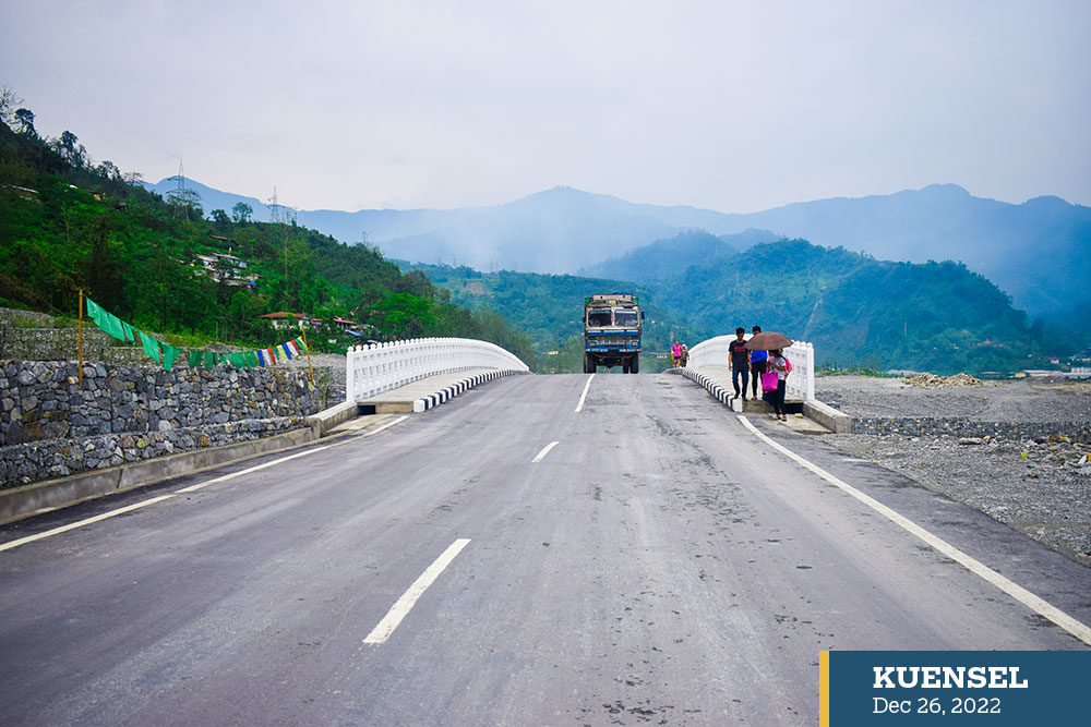
As the gateway to the country, nearly 80 percent of the imports come from Phuentsholing. To ensure smooth transportation of goods, the government has invested billions of Ngultrums in improving and securing infrastructure – the lifeline of Bhutan.
However, the border town has challenges, mostly related to climate change, that could jeopardise the very economic lifeline.
Untimely and incessant rainfall each year has become a threat to important development projects; even posing threat to lives.
In 2000, the southern foothills experienced heavy and abnormal rainfall. That summer saw a heavy rainfall, historically the highest in a day in the country, according to the National Centre for Hydrology and Meteorology (NHCM). That summer, the Barsachhu in Pasakha swelled to unexpected levels washing away properties and even claiming lives.
Although people have recovered from the experience of the devastating flood, the threat still looms.
In May 2019, the 50-metre multicellular culvert box bridge over the Baunijhora stream was completed. A huge gabion wall was constructed upstream. The Asian Development Bank (ADB) had appropriated Nu 132 million (M) for the gabion wall and Nu 115M for the multicellular bridge and a 1.3km road.
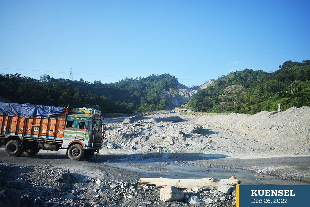
The place where Baunijhora bridge is submerged and invisible now
The infrastructure failed their first monsoon test. A flash flood caused by heavy rain on June 24-25 that year damaged the entire infrastructure. The wall, bridge and the road got submerged under debris. There is no trace of the infrastructure today. The Phuentsholing Thromde, that year, recorded property damages worth Nu 7.85M, excluding the Baunijhora bridge.
In June this year, a landslide killed a woman in her room at Kabreytar. In June 2021, a 39-year old woman and her seven-month old son were killed when a landslide washed away their house at Naudhokay village in Pasakha. Before this, in 2015, Amochu flooded the Bangay Bazar and left behind seven families homeless. Amochhu also flooded in 2016 causing huge losses.
What does the thromde say?
Thrompon Uttar Kumar Rai said Phuentsholing has seen massive infrastructural destruction and loss due to heavy rainfall every year.
“It is obviously because of climate change,” he said. The concern, he said, is that the entire Phuentsholing, from Chamkuna to Pasakha rests on phyllite and clay soil, which is young and fragile.
Uttar Kumar Rai said climate change was not considered a threat before. However, the thromde now considers climate aspects in its planning.
Due to the fragile soil condition, mitigation challenges are immense. More than the thromde core areas, it is the rural outskirts that are risky and need mitigation because they are located at a higher elevation and are source to landslides and floods.
“We have invested millions on the Omchhu riverbank protection. But all these investments are wasted when it rains and the river swells up,” thrompon said.
“If these outskirts are managed and mitigated, all will be okay.”
In 2018, mitigation works were carried out in three landslide-prone areas in Phuentsholing under the National Adoption Program of Action (NAPA)-II project funded by Global Environment Facilities (GEF). GEF provided a fund worth over USD 4.38M.
One of them was the slope below the old Rinchending checkpost. In the summer of 2021, the landslide relapsed causing a crack on the road on the checkpost road posing risk to the new integrated checkpost.
Uttar Kumar Rai said Phuentsholing Thromde is not the only organisation that brings and develops infrastructures in Phuentsholing.
“Almost all the mega budgeted infrastructural development is carried out by other organisations. Here is the challenge,” he said.
“Once the projects are completed, they are handed over to us. We don’t have the maintenance budget.”
The Thromde currently allows private constructions after studying the geological conditions and rainfall-related risks assessment, design, and load-bearing capacity assessments. However, they don’t do it at the Climate Change-level of assessment.
Phuentsholing Thromde also has no data about the records and details of old buildings across Phuentsholing. Private building owners have been asked to survey and submit the reports.
Is PTDP climate change resilient?
The biggest infrastructure currently under construction is the Phuentsholing Township and Development Project (PTDP)-Zone A on the Amochhu embankment.
The budget is USD 93M.
PTDP will develop around 157 acres of vacant riparian land adjacent to Phuentsholing. It is expected to bring about robust economic growth and space for human settlement.
Project manager with Construction Development Corporation Limited (CDCL), Kamal Dhakal, said the river training and embankment protection works are constructed to withstand the flood.
“There is no natural or man-made storage in the catchment to attenuate flooding. The river channel is designed to cater to the designed flood event plus 10 percent climate change factor. In addition, a free board of 1-metre is maintained throughout the river protection structure,” he said.
Before the approval of the project design, a thorough study on Project Climate Risk Assessment and Management was also done by the consultants, vetted by experts from ADB. The outfalls (drainage) structures in PTDP are also designed to cater to maximum monsoon flow.
With the completion of 4.5km river-training structures along the Amochhu river, the threat of flooding from the Amochhu river is minimised to a considerable extent. It is expected that any flood events below 100 years AEP (7100m3/sec) will not pose a major threat to Phuentsholing.
However, the cross drainage structures (outfalls) from the Dhamdara hill are very sensitive to the predicted increase in frequency and intensity of precipitation, which will result in more severe flooding along the outfalls, Kamal Dhakal said.
These outfalls are sensitive to sediments and debris flow from landslides at the upstream of the project area. Every monsoon, the outfalls are filled with debris, which causes overflow of water and flooding along the vicinity.
Kamal Dhakal said the management of these sediments and debris needs to be done at the source itself, and it requires a collective approach from all stakeholders.
“Excavating the hill base for infrastructure development by private individuals and government agencies requires a critical approach,” he said.
“Along with infrastructure development, landslide protection works also need to be taken up to minimise impacts downstream. If not cautious, PTDP project and the Amochhu Local Area plan (LAP) is at a high risk of flooding from the cross-drainages caused by debris flow from the hill.”
What does NCHM say?
According to the NHCM, Bhutan receives more than 70 percent of rainfall from the South West Indian monsoon rainfall that comes from the Bay of Bengal. The chief of the weather and climate services division at NCHM, Dr (PHd) Singay Dorji, said Bhutan has data since 1996 and the records do not show a significant and continuous increase in rainfall and the variations are seasonal.
“Rainfall in Phuentsholing is not increasing each year. The annual total rainfall has not changed significantly and the variations are seasonal,” he said.
NCHM today operates an Interim Flood Early Warning System (FEWS) on Amochhu basin that is based on real time observation of the hydrological and meteorological parameters from the automatic weather and hydrological stations located upstream of Amochhu, combined with weather forecast products from NCHM. As part of the interim FEWS, early warning facilities are also installed to warn the communities and the project area.
Dr Singay Dorji said that one of the ways to reduce flooding impact is to use non-structural measures like hazard maps for planning settlement and establish FEWS for warning during the extreme weather events.
“Floods in southern Bhutan are flash floods, which are difficult to forecast. NCHM is currently working on establishment of a Comprehensive FEWS on Amochhu basin with the funding support from PTDP project through CDCL.”
“The FEWS shall be based on a detection and forecast-based early warning system that would also take into consideration of sedimentation issues.”
As per the NCHM, the FFIR is the leading cause of flooding in the southern region. To reduce the impact from such events, a comprehensive flood forecasting and warning system that forecasts the hydrological and meteorological components with capability to disseminate the information and warnings to the communities is critical.
Dr Singay Dorji said Phuentsholing Thromde may have to plan actions resulting from forecast and warnings issued from the comprehensive FEWS and conduct regular education and awareness programmes on flooding impacts including the awareness on response during the event besides other structural interventions to reduce flooding impacts.
“According to the Intergovernmental Panel of Climate Change (IPCC), the global average temperature has warmed by more than 1 degree celsius from the pre-industrial level. Research has shown that the rainfall has become more intense (more rainfall in a shorter duration) due to climate change,” Dr Singay Dorji said.
“Globally extreme weather events are on the rise and Bhutan is no exception. Rainfall is projected to increase due to climate change, but it has not happened in many places. In Bhutan, the annual total rainfall has not changed significantly.”
Meanwhile, a resident in Pasakha, Som Bdr Rai, who still remembers the 2000 Barsachhu flood said millions have gone to waste due to heavy rainfall.
“The best example is Baunijhora bridge,” he said, adding school-going children in Pasakha are unable to go to Chumithang middle secondary school when the stream swells up.
“This is not new.”
Som Bdr Rai said the government and the local leaders must act.
The story is funded by Bhutan Media Foundation’s climate change reporting grant.