
Status of Groundwater in Bhutan
Water stored underground beneath the earth’s surface in the spaces created by geological formations is referred to as groundwater. Groundwater abstraction using boreholes is a very common sight while traveling through Assam to Phuentsholing and Samdrup Jongkhar. Abstraction of groundwater in Bhutan may be an alternative water source for meeting increasing water demand for domestic and agriculture. For example, groundwater has been surveyed for rehabilitation of the Yudhiri irrigation system in Radhi Gewog by JICA in 2017. However, there is limited information on the status of groundwater reserves in mountainous regions like Bhutan. Thus, the article proposes a scientific approach towards establishing baseline information on groundwater resources in Bhutan.
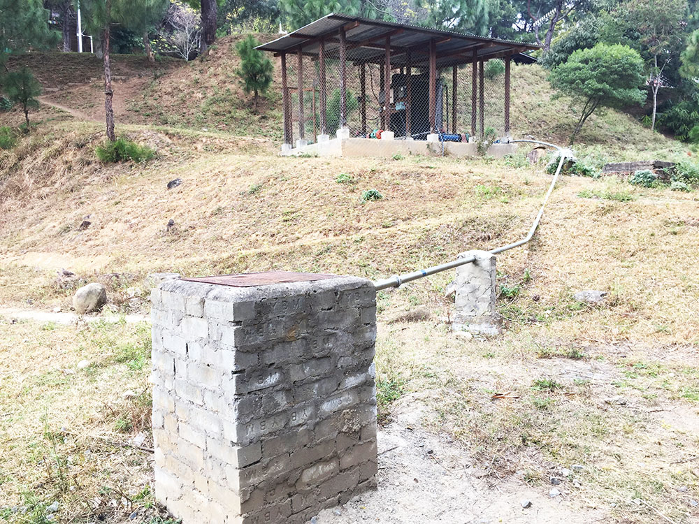
In fact, groundwater is already being extracted as an alternative water source in some dzongkhags – Paro, Thimphu, Wangdue Phodrang, and Punakha often to compensate for the drying up of spring water sources. Abstraction of groundwater is expected to increase in the future as indicated by the growing number of private entrepreneurs offering services of mobile drilling rigs for digging boreholes. Despite some legal frameworks providing guidance for groundwater management in the country, there is no limited scientific baseline information to support our decision-making in terms of groundwater management.
Given Bhutan’s geographical location, it is expected that we may have limited groundwater resources to meet increasing demands for both domestic and agricultural use. There is no long-term field study monitoring the groundwater resources. Bhutan’s groundwater systems could be intricately linked with surface water bodies as reported by a recent isotope study conducted along the Chamkhar Chu basin. Thus, a holistic approach to water resources management including both surface and groundwater is critical.
Springwater sources, one of the primary sources of drinking water across the country is also intricately linked to underground aquifers. The presence of springs in the mountains indicates the presence of groundwater in our mountainous region, though unlike in Indian plains, the groundwater aquifer in the mountainous region is relatively small, localized, and is shaped by geological structures. Considering the complexity of the geological formation of the Himalayan range, groundwater flow could be significantly affected by it. Thus, before Bhutan ventures into a large-scale abstraction of groundwater, it is essential to map the dips and strikes of inclined bedrocks to better understand our aquifers and their hydrogeological formation. A recent study conducted by Jambay and Uden (2021) on hydrogeological mapping in the southwest part of Bhutan, reported that groundwater flow is considerably altered by geological structures like faults, fractures, and unconsolidated forest debris acting as an unconfined aquifer.
Proposed Steps for Groundwater Abstraction
Firstly, surface and subsurface exploration before drilling groundwater is critical. Drilling for groundwater is costly, and drilling in random sites often fails to locate the groundwater. Such incidents have already been reported from some parts of Bhutan. Thus, spatial and Geographic Information Systems (GIS) can be used to understand the depth and nature of groundwater availability coupled with geophysical electrical resistivity techniques. The actual drilling of the borehole should proceed only after an approximation of the availability of groundwater at the proposed sites.
Secondly, for borehole drilling to be successful numerous interdisciplinary experts need to be consulted for better understanding the key environmental factors such as the porosity, soil moisture content, geology – rock-types, and changes in the soil profile. Gathering undisturbed core samples and later analysis in the laboratory would provide insights into the aquifer’s characteristics. Examination of the core samples could be completed at a standard laboratory such as one at the College of Natural Resources in Lobesa.
The third step is to quantify the available water within the aquifer and determine how much can be drawn from without draining all the water, as is the case with some wells in Thimphu and Paro that are already dried up. Understanding aquifer characteristics and borehole testing could also provide quantitative estimates of those key parameters. Pumping more than aquifer recharge can reduce the water quantity and quality in the well and also associated surface waters and overall ecosystem health. Further, the percolation of sewers, agricultural runoff, and floodwater may also deteriorate the groundwater quality.
Fourthly, the users of boreholes should understand the performance of their aquifers – they should be aware of the safe yield, that is, the maximum amount of water that can be drawn from a well in a day without causing it to dry up. Aquifers in mountains are much more complex to recharge artificially than those in plains. The hydrogeological layout mapping of springs can be used to identify potential recharge zones on mountains. It is also possible to artificially recharge these zones through spring-shed management. However, without understanding the hydro-geological dynamics of groundwater aquifers the artificially created recharge zone may not always result in recharging the intended aquifer. This is because high relief of the surface topography in Bhutan may drive deeper groundwater circulation, which might be recharging regional and even continental-scale flow systems as reported in a recent study on groundwater in high mountain environments by Somers & McKenzie in 2020. Or maybe recharging could also result in shallow circulation without much contribution to the actual aquifer. Although it comes with huge financial implications there is a critical need to start working towards establishing be a long-term plan for the installation of groundwater monitoring boreholes. Further, as highlighted by JICA’s report on rehabilitating irrigation schemes to the Ministry of Agriculture and Forest in 2017, a robust hydro-meteorological data collection needs to be put in place for exploring the use of groundwater resources.
With an increasing number of boreholes being drilled in random sites all over Bhutan, it is imperative these key steps need to be taken while the relevant agencies ensure that boreholes are monitored, safe yield levels are established for sustainable production of water. This in a way could avoid numerous unintended consequences including lowering the water table causing lakes and springs to dry up. A ‘green signal’ to drill boreholes for groundwater abstraction under limited baseline information could potentially affect all kinds of water resources management interventions within the same catchment and have negative impacts on downstream.
The article is published based on personal experiences and observations by a group of water researchers from Bhutan. The group can be contacted at waterresearchbhutan@gmail.com