
Thukten Zangpo
Bhutan launched the second nano-satellite, India-Bhutan SAT (INS-2B) on November 26, marking yet a historic milestone in its space journey.
Indian Space Research Organisation’s (ISRO) Polar Satellite Launch Vehicle (PSLV) launched the satellite jointly developed by India and Bhutan into space. The PSLV C54 carried the India-Bhutan SAT, along with India’s Earth Observation Satellite-06 and other satellites from Satish Dhawan Space Centre in Sriharikota, Andra Pradesh.
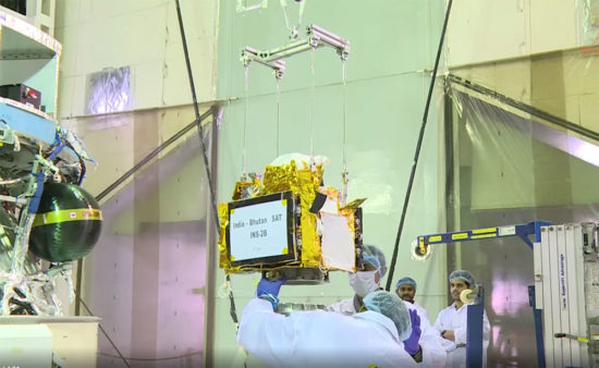
The satellite was built by four engineers from the Department of Information Technology and Telecom (DITT) under the information and communications ministry, Bhutan and India.
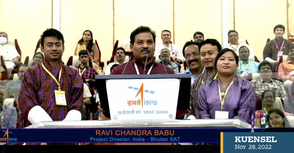
Presenting His Majesty The King’s message on the successful launch of the satellite at the event in Thimphu, Prime Minister Dr Lotay Tshering thanked the Indian government, the ISRO, and the team.
The Prime Minister of India, Narendra Modi also tweeted “India-Bhutan satellite is a testament to our special relationship with the people of Bhutan”.
India’s External Affairs Minister of India, Dr S Jaishankar said that the historic milestone could be achieved because of the collaboration of the dedicated team of space engineers and scientists from ISRO and Bhutan.
Indo-Bhutan satellite was launched from Sriharikota, Andra Pradesh on November 26
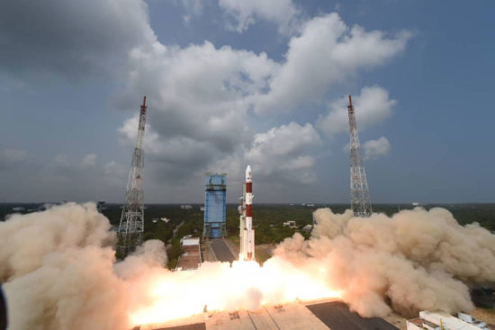
Polar Satellite Launch Vehicle carried nine satellites
“Recognising the positive impact, the South Asia satellite would have on the socio-economic development of Bhutan in areas such as communication and disaster management, Prime Minister Narendra Modi has offered increased bandwidth on an additional transponder for Bhutan’s requirement as a gift to the people of Bhutan,” he added.
The satellite has the primary capability of acquiring optimal images using the Nano-Mx payload, which was developed by the ISRO. This will capture images of Bhutan in four spectral bands.
The ground spatial resolution that can be achieved is 29 metres as the satellite gets positioned at 506 kilometers above the earth’s surface.
The satellite image data will be used for applications such as forest canopy mapping, human settlement growth, landslide studies and rooftop solar power potential estimation by the remote sensing group.
The secondary payload, which is designed and built by Bhutan, will be able to broadcast text messages from the orbit for amateur radio users using its digipeater payload.
India has provided hands-on training in satellite building and testing, processing and analysing satellite data to the Bhutanese engineers at the UR Rao Satellite Centre in Bengaluru.
Five colleges of the Royal University of Bhutan-Royal Thimphu College, Sherubtse College, College of Science and Technology, Jigme Namgyel Engineering College, and Gyelpozhing College of Information Technology have established amateur radio ground stations. An additional radio station will also be established at the Druk Gyalpo’s Institute in Paro.
The satellite weighs 17.8 kilogram and has a mission life of 6 months.
ISRO is also working with Bhutan on establishing a ground station in Thimphu for receiving the data from the satellite.
In August 2019, India and Bhutan jointly inaugurated the South Asia Satellite ground station in Thimphu.
Bhutan-1 country’s first satellite, an education CubeSat was launched in space on August 10, 2019 by four engineers with DITT as part of their master’s degree in Japan under BIRDS-2 project.