
Chhimi Dema
Bhutan has about 700 glacial lakes. The earth’s rising temperature means glacial lake outburst floods (GLOF) are ever present.
The recent GLOF alarm came from Thorthormi Subsidiary Lake II on June 20, 2019. No casualties were reported during the event.
It is events such as this that call for advanced technology and expertise for preparedness and response to hazards related to hydrology and meteorology.
As a scientific and technical organisation, the National Centre for Hydrology and Meteorology (NCHM), provides the country with information and services related to weather, climate, cryosphere, meteorology, hydrology and water resources.
Little known to people, many activities such as daily weather forecast, preparing reports for extreme weather events, studying the country’s hydrology, and preparing hazard maps are being carried out at the centre.
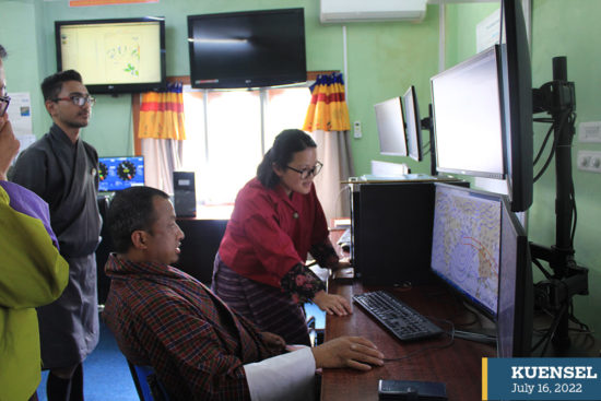
Flood monitoring and command room
Hydrology and Water Resources division’s chief, Tayba Buddha Tamang, said that the division provides hydrological services such as daily hydrology forecasting and early warning for associated hazards risks such as GLOF and floods.
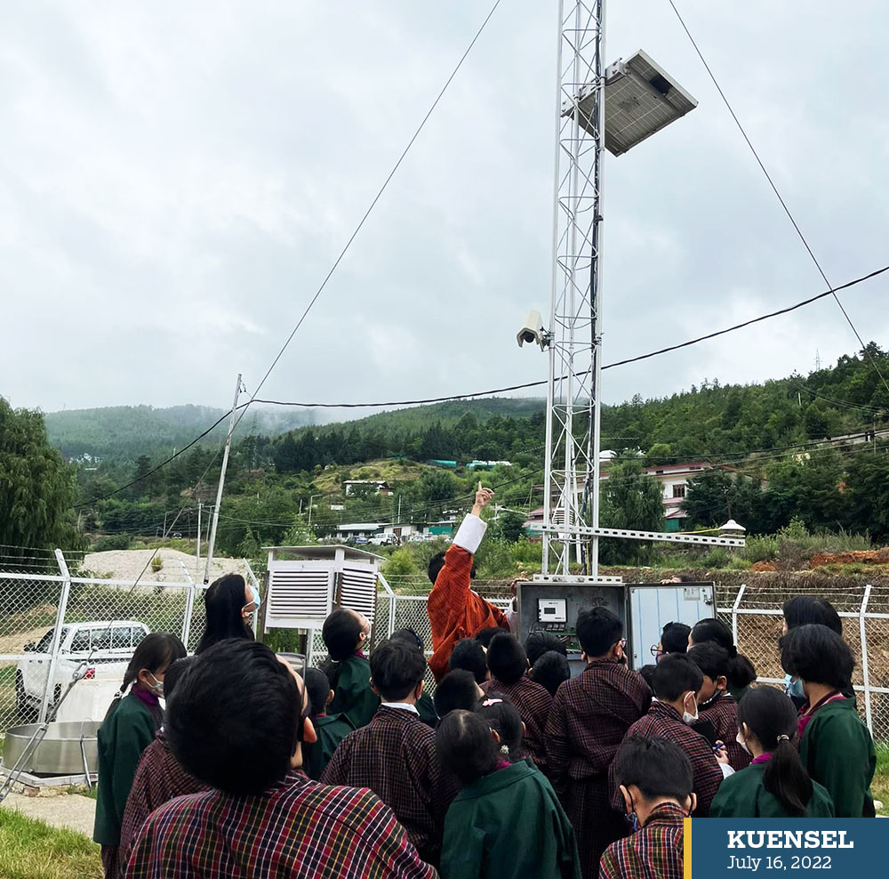
The first early warning system was installed in the Punatsangchuu, followed by installations in Mangdechuu, and Chamkharchuu river basins to monitor the water level and warn the vulnerable communities of a flood.
Recently, with support from JICA, NCHM launched a project to install an early warning system in the Wangchhu river basin.
Currently, the early warning systems in the three rivers are “detect and warn” systems which send data to the control rooms in case of an increase in water level at the stations.
Tayba explained that this gives a short duration to evacuate.
“NCHM plans to give forecasting-based early warnings that would give more time for hazard or disaster preparedness,” he said.
Compared to a decade ago, the technology in forecasting and early warning has evolved.
Tayba said: “All the data keeping and communication were done manually then.”
The observations from the hydrological stations were shared over the telephones. Unless an individual was present at the stations to provide data, there was no technology to extract data.
Today, the centre has automatic water level stations transmitting data every 30 minutes to the control rooms using Global System for mobile communication (GSM) or General Packet Radio Services (GPRS) technology.
There are hydrological stations (manual and automatic) in 20 dzongkhags measuring water level and discharge, and making sediment analysis.
Tayba said that the centre plans to install the forecast integrated flood early warning in the Amochhu river basin.
“With improving science, the hydrological services are advancing so the information we provide is becoming reliable,” Tayba said.
The division conducts hazard mapping and modelling which highlights areas that are affected by or vulnerable to flood.
NCHM also provides data to the hydropower sector or industries before their design and planning.
Tayba said that minding the importance of communication in providing early warning for a hazard, the centre is in dialogue with the Ministry of Information and Communications to connect the water level stations with fibre optics to feed real-time data to the control rooms.
He said that the water level stations located in deep gorges make it challenging to receive telecommunication signals.
Weather forecasting centre room (WFCM)
From plantation of paddy to arranging travels, the weather forecast is critical.
NCHM provides four national weather updates in a day, at 12 noon, 4 pm, 6 pm, and 4 am.
The city forecast consisting of the weather forecast for eight dzongkhags is provided to the World Meteorological Organisation at 6 am and 6 pm.
The centre also provides aviation forecasts to the Paro International Airport within an hour and a half an hour daily.
In addition, NCHM’s SmartNet System pushes the forecast to the agriculture ministry’s agro-meteorological server.
The forecasting centre room, stationing forecasters and officials who run monitoring and preparing forecasts, continue without disruption or downtime.
The Weather and Climate Services Division’s deputy executive engineer, Monju Subba, said that for weather forecasting; temperature and rainfall observations from Class A stations, and satellite images from a Japanese satellite, Himawari, are used.
The centre uses a downscaled model which examines small areas in detail to generate locally relevant weather patterns.
It uses the numerical weather prediction model which employs a set of equations and parameterisations such as topography, evaporation, vegetation, soil properties and rain, among others, to predict the weather.
The centre also checks the weather information from the Indian Meteorological Department and other global models to produce a reliable forecast.
After running the models, the division arrives at a decision on the weather predictions for the country.
Monju said that weather forecasting has improved with the introduction of the SmartNet System, and the weather research and forecasting (WRF) model.
WFR model allows to zoom in on the country from a global scale of weather prediction. The SmartNet System provides satellite images, model running, and weather visualisation in a system making it convenient to make forecasts.
The centre provides weather information to the transport sector through WhatsApp and forecasts before national celebrations.
Monju said that while advanced technology is helpful there is the requirement for knowledge and skills to operate it.
She said that the centre is working on providing a long-range forecast for the agriculture sector’s use.
Recently, the centre started providing weather information to rural communities through BBS Radio and Kuzoo FM, and impact-based forecasting gives information on a weather’s impact such as flash floods.