
Yangyel Lhaden
Bhutan hosts approximately 800 community forests. Nevertheless, disputes frequently emerge even after the forest is officially designated, especially when private land lies within its boundaries.
A prominent ongoing conflict pertains to the grazing rights within these communal forests. Individuals assert ownership of portions of the forest, contending that it falls under their private land within the community forest.
The absence of baseline geo-spatial data has hindered the resolution of this issue. However, the intervention of the National Land Use Zoning Baseline Report 2023 (NLUZ 2023), produced by the National Land Commission Secretariat (NLCS) and developed with the collaboration of 12 agencies using geo-spatial data, has brought resolution to this longstanding issue.
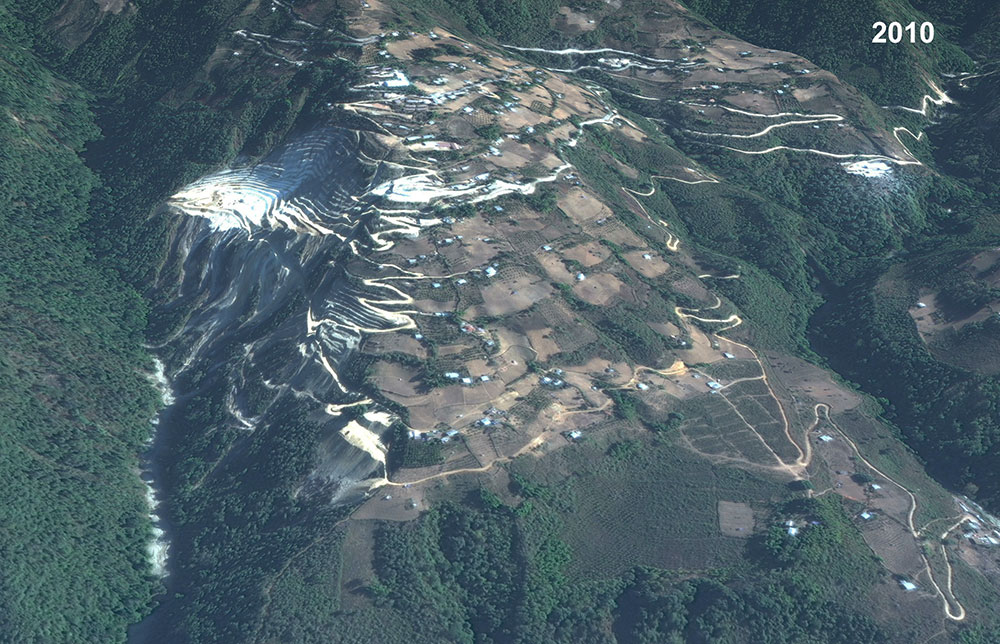
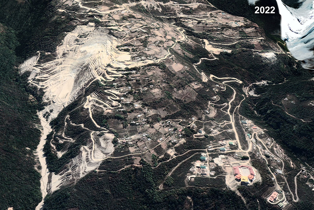
A school, including a large number of residents, was relocated due to Gypsum mining expropriation in Pemagatshel due to improper mining prospectus
NLCS and the forest department sat down together, referring to the baseline data and mapping the community forests, facilitating the identification, and exclusion of private lands from these designated areas.
Similarly, NLCS aims to resolve over 435,000 acres of land use conflicts identified through the NLUZ 2023 by 2025 through harmonised land uses with proper ordinances.
A land conflict is a disagreement over the ownership, use, or control of land or natural resources. It often involves competing claims to land, boundaries, or resources and requires resolution through legal, regulatory, or negotiation processes.
Conflicts in land use covering 418,561.353 acres of agricultural land have been identified. Among these, approximately 315 acres are occupied by cultural activities, around 115 acres by industrial endeavors, roughly 31,100 acres serve as nature conservation areas, and over 1,800 acres are designated for urban development.
“We are embarking on groundwork to resolve land conflict issues and validate these conflicts on-site, utilising data from our desktop study, which has revealed over 435,000 acres of land use disputes to produce one national data,” an NLCS official said. “Baseline data shall be the starting point and basis to start the land use conflict negotiation and our goal is to eliminate land use conflicts entirely over time.”
He emphasised the importance of collaboration among relevant agencies for the successful implementation of the project, highlighting land use conflicts as a cross-cutting issue. “Currently, there is no proper guideline for agencies when claiming land for a specific use. For example, there is limited designation of land uses; for instance, there is no designation of protected agricultural land.”
Regarding conserving nature mandate, he emphasised the need for clear definitions when delineating protected areas where human settlements may exist, along with defining permissible activities within these areas. “Agencies involved in land use must have clear mandates and definitions to resolve and reconcile land conflicts and we aim that, over time clear, definitions will be in place to mitigate land use conflicts easily.”
The official said that the land use zoning has included high conservation values in the overall land use zones to ensure support for any form of land use zoning. “Through this land use zoning, better designated land uses can be ensured technically, be it near to protected areas or critical land uses. The permissibility of land uses in such areas shall be defined and advocated to the residents. This shall also form as a basis for used based land valuation.”
Without proper planning, there is a risk of haphazard construction and land use, and when land use changes due to these factors, they need to be reconciled and resolved to avoid land use conflicts, the official said. “There exist significant land use conflicts that demand resolution. Failure to address these conflicts carries substantial costs for the country, encompassing social, financial, and environmental dimensions.”
As an example, in Pemagatshel, a school and a sizable portion of its residents were relocated due to the expropriation of land for gypsum mining. This relocation was necessitated by improper mining prospectus with inadequate consideration of land use zoning. The resultant displacement incurred significant costs for the state.
Some examples of land use conflicts highlighted in the NLUZ 2013 report include the construction of Bayling Central School in Trashiyangtse. The school is built entirely on protected Chhuzhing land, which raises concerns regarding land use zoning. Additionally, the construction has disturbed a portion of the roosting ground for the nearly threatened black-necked cranes, further exacerbating the conflict between development and conservation efforts.
A school in Pasakha, Chukha, situated within the industrial estate, was relocated due to concerns related to emission standards and health hazards posed by industrial activities. The decision to relocate was prompted by the need to ensure the well-being of the students and staff. However, this relocation resulted in numerous social inconveniences for the community.
The Rangjung Technical Training Institute in Trashigang was constructed within the river buffer zone without proper assessment of flood risks. Consequently, during the 2004 flooding, half of its campus was washed away.
“The baseline report is mainly to implement what is outlined in the land Act 2007, particularly the section 302 and 303 to designate the land use zones in the country based on the capability and suitability aspects of the land,” the official said.
The NLUZ 2023 report was supported by WWF Bhutan, the International Climate Initiative, the REDD+ framework, and other agencies.