
How can Bhutan avoid another disaster such as Ungar flash flood that claimed the lives of more than 20 family members camped along the riverside of Yungichhu under Lhuntse in July 2023? From a workplace health and safety standard, first, relevant authorities must review safety and risk mitigation measures to avoid building labour camps in a floodplain or flood prone areas. Second, detailed pre-flood risk and impact assessments using cutting-edge technology in the form of unmanned aerial vehicles and satellite imagery should be implemented to identify vulnerable work areas. A simple post-flood assessment conducted by agencies after the Ugnar incidence as reported in the newspapers won’t be enough to protect communities from similar incidences in future.
Hence, as a group of water technology and management experts, we propose concerned agencies in Bhutan to embark on a mission to utilising available data or start gathering relevant in-depth hydro-meteorological data to assess the likelihood of similar events especially in flood-prone urban centres such as Phuntsholing, Gelephu, Trashigang, Trashiyangtse, and many others. Without proactive risk assessments and respective mitigation activities, similar events from monsoon or excessive snowmelt could occur in vulnerable areas resulting in a similar tragic loss of human lives and infrastructure.
Floods are often defined according to their likelihood of occurring in any given year. The most used definition in planning is the ‘1 in 100-year flood’ – an ‘Annual Exceedance Probability’ (AEP). For example, a 1% AEP flood means, in any given year, there is a 1% chance (or 1/100) of flood of that size or larger occurring. The relevant technical agencies in Bhutan must invest in developing hydrological models and propose the estimated AEP for flood-prone areas across the country.
Having an AEP for a site should then be used as one of the guiding standards of health and hazard safety standards for human settlement and infrastructure development. Although such procedures may not be able to fully eliminate the chances of a flood occurrence, deciding what level of flood risk is acceptable for individuals and the community is important for planning purposes. This should take into consideration both the probability of a flood occurrence and the consequences of a flood.
There are often strong social and economic reasons for considering a higher standard than the 1% AEP flood. For example, in some locations flood levels associated with rarer floods are significantly higher and are likely to cause significant devastation; inundation of a particular location may have significant economic and social consequences for a much wider region. For example, London is reported to be moving to a planning level above the ‘1 in 500-year flood’ (0.2% AEP) for land adjoining the Thames estuary. Also, many parts of the Netherlands are known for using planning levels above the ‘1 in 1000 year’ coastal flood event (0.1% AEP), because inundation of large, low-lying areas would have major consequences. Currently, the 1% AEP event is designated as having an ‘acceptable’ risk for planning purposes nearly everywhere in Australia, while researchers suggest that good planning needs to consider more than just the 1% AEP flood. For Bhutan 1% is recommended given the higher flood risks associated with fragile topography and monsoon although lower AEP thresholds might be applicable in certain areas? To propose a reliable AEP, a detailed study of past flood events and return period needs to be conducted.
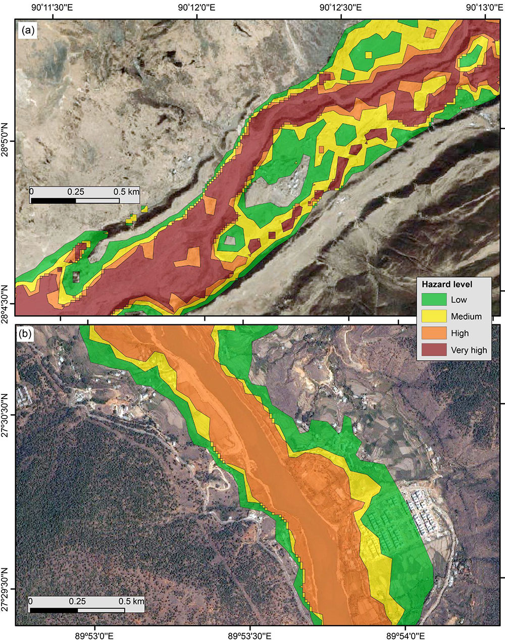
The relevant agencies in Bhutan should prepare flood risk maps which are digital representations of river and streams, drainage basin, topography, floodplain land use and land cover, and associated existing and future proposed infrastructure. Moreover, the map can incorporate additional features such as elevation, roads, embankments, and river sizes to estimate predicted flood flows. The output of the models such as the predicted flood depth and flow velocity should be publicly available via online portals. Additionally, capacity building of engineers and planners at the district and local governance levels, to interpret flood risk products and guide development plans, should be a priority to minimise tragic flood-related incidents.
The article is published based on personal experiences and observations by a group of water researchers from Bhutan. The group can be contacted at waterresearchbhutan@gmail.com