
Chhimi Dema
The National Land Commission Secretariat (NLCS), with a state-of-art mapping drone, will strengthen its surveying and mapping practices.
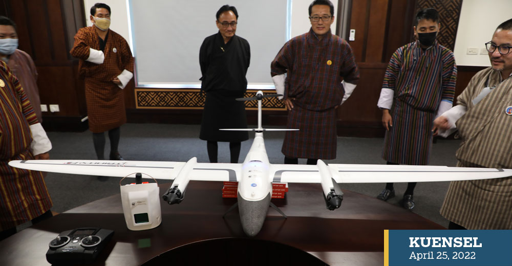
The Trinity F90+ mapping drone was handed over by the World Wildlife Fund (WWF) Bhutan to NLCS yesterday.
The drone and other IT equipment worth Nu 8.29 million were supported as part of the Living Landscape: Securing High Conservation Values (HCV) project, funded through the International Climate Initiative by the German Federal Ministry for the Environment, Nature Conservation, and Nuclear Safety.
The eight-year project was launched in October 2020.
The project is being implemented by the WWF Bhutan and Tarayana Foundation in collaboration with the Department of Forests and Park Services and NLCS.
Value in HCV is the area containing environmental and social values such as watersheds, grassland or archaeological sites of high significance or importance.
Identifying the areas of value is the first step in developing appropriate management for them. The drone will be used to recognise these high conservation value areas.
WWF Bhutan’s programme coordinator, Younten Phuntsho, said: “The project contributes towards Bhutan’s pursuit of holistic and sustainable development, by seeking to secure and maintain ecological, biological, cultural and or social values for the benefit of people and nature.”
He said that the use of drone technology will enable NLCS to accurately map HCV sites and carry out National Land Use Zoning.
The National Land Use Zoning exercise will establish a land-use system that will revalidate and delineate the existing national parks, biological corridors, agricultural land, industrial areas, human settlements, heritage sites and others based on consultation with concerned sectors.
The mapping drone, equipped with RGB (red, blue, and green colour) and LiDAR (Light Detection and Ranging) sensors, is applicable for use in surveying, GIS Services, mining, construction, energy, agriculture, and environmental monitoring, forestry, research and education, and emergency services.
The LiDAR technology uses pulsed laser to generate accurate 3D information about the earth’s surface.
NLCS’ director, Tenzin Namgay, said that the images acquired through drones would be useful in detecting land use land cover changes.
The last land use land cover (LULC) mapping was conducted in 2016.
Tenzin Namgay said: “Drone images will also provide an efficient technology for updating topographical base maps, which is a fundamental geospatial information for building spatially-enabled decision support systems.”
He added that NLCS intends to work with stakeholders to create an enabling environment and establish professional capability in the adoption of drones for surveying and mapping.